vue项目中openlayers画行政区划(区域范围),供大家参考,具体内容如下
原理
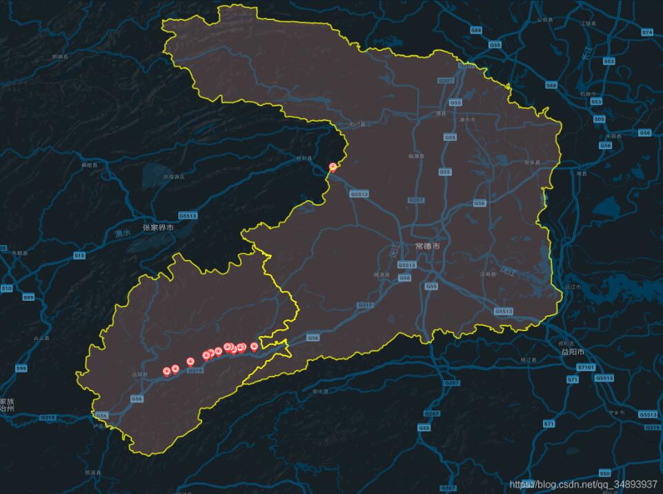
在地图上画需要的范围,实际上就是在地图上打上一圈点,然后依次将这些点用线连接,就形成了范围
引用相应的ol模块
import VectorLayer from 'ol/layer/Vector'
import VectorSource from 'ol/source/Vector'
import { Map, View, Feature } from 'ol'
import { Style, Icon, Stroke } from 'ol/style'
import { Point, LineString, Polygon } from 'ol/geom'
获取范围点
这里我将点放在json文件中,然后通过axios读取
json文件截图:

axios.get('static/常德市.json').then((res) => {
 let arr = res.data.coordinates
 let polygonFeature = new Feature({
   type: 'polygon',
   geometry: new Polygon(arr[0])
  })
  polygonFeature.setStyle(new Style({
   stroke: new Stroke({
   width: 2,

   color: [255, 255, 0, 0.8]
   }),
   fill: new Fill({
   color: [248, 172, 166, 0.2]
   })
   // text: new Text({
   // text: '这是区域'
   // })
  }))
  let polygonLayer = new VectorLayer({
   source: new VectorSource({
   features: [polygonFeature]
   })
  })
  this.gmap.addLayer(polygonLayer)
  })
  axios.get('static/怀化市沅陵县.json').then((res) => {
  let arr = res.data.coordinates
  let polygonFeature = new Feature({
   type: 'polygon',
   geometry: new Polygon(arr[0])
  })
  polygonFeature.setStyle(new Style({
   stroke: new Stroke({
   width: 2,
   color: [255, 255, 0, 0.8]
   }),
   fill: new Fill({
   color: [248, 172, 166, 0.2]
   })
   // text: new Text({
   // text: '这是区域'
   // })
  }))
  let polygonLayer = new VectorLayer({
   source: new VectorSource({
   features: [polygonFeature]
   })
  })
  this.gmap.addLayer(polygonLayer)
  })
以上就是本文的全部内容,希望对大家的学习有所帮助,也希望大家多多支持站长技术。
原文链接:https://m.jb51.net/article/202801.htm
版权声明:本文转载自网络,遵循 CC 4.0 BY-SA 版权协议,转载请附上原文出处链接和本声明。本站转载出于传播更多优秀技术知识之目的,如有侵权请联系QQ/微信:153890879删除
 相关文章
相关文章-

vue项目中openlayers绘制行政区划
-
在HTML中使用JavaScript的两种方法
-
vue+openlayers绘制省市边界线
-
Vue仿百度搜索功能

 精彩导读
精彩导读

 热门资讯
热门资讯